

At 360 Drone Visuals, we specialize in taking breathtaking aerial images using state-of-the-art drone technology. Our goal is to showcase your location from a unique and captivating perspective, providing a full, 360-degree view of the surrounding area. Whether you're looking to showcase a residential property, commercial real estate, or even an event, we offer a range of packages to suit your needs.
At 360 Drone Visuals, we use top-notch drones and talented pilot to whip up amazing footage just for your project. Check out our awesome footage and see what we can do! We’re all about bringing your vision to life from the ground up!
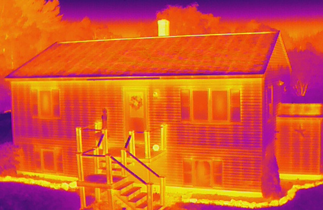
At 360 Drone Visuals, we provide top-notch thermal imaging services that help our clients identify anomalies from energy efficiency to underlying defects unseen to the naked eye. We use state-of-the-art technology to capture, measure, and analyze thermal images, delivering comprehensive reporting to give our clients a clear understanding of their buildings condition.
At 360 Drone Visuals, we offer a unique and convenient solution for capturing large areas in great detail. Our drone modeling services are perfect for planning and tracking, open areas, providing our clients with valuable insights that can help with decision-making. With our help, you can get up-to-date information about your project or property layout in multiple file formats.
Here's What We Provide

-
FAA Part 107 Licensed Operator
-
Quick Deployment Time
-
Client Based Services
-
Easily Shareable Deliverables
-
4K Ultra HD Video
-
Level 1 Thermographer
-
Qualitative And Quantitative Approach
-
Drone Law And Airspace Knowledge
-
Personalized Reporting
-
Industry Leading Technology


Mid-Coast Maine Drone Photographer
Welcome to 360 Drone Visuals, where we utilize the latest drone technology to provide professional and innovative aerial services. Whether you’re looking for stunning aerial real estate photography, breathtaking promotional videos, or thermal imaging, we’ve got you covered. Our team is passionate about creating customized solutions that cater to your unique needs. We place high value on communication and collaboration, ensuring that we understand and exceed your expectations with every project we take on. Thank you for your interest in our services, and we look forward to working with you.
Servicing Mid-Coast Maine And Beyond...

Q: WHAT SERVICE AREAS DO YOU COVER?
A: We cover the Mid-Coast of Maine, however we can cover the entire state for larger projects.
Q: HOW LONG IS THE TURNAROUND TIME?
A: The majority of projects will be completed and returned within 2-3 business days. However, this number can vary depending on the type of deliverable being produced.
Q: HOW DO I RECEIVE MY DELIVERABLES?
A: We provide our deliverables through a downloadable link in Google Drive making it easy for you to access and share your images and video with others.
Q: HOW IS PAYMENT PROCESSED?
A: We accept payment through a variety of methods, including credit/debit card (online invoicing) or check.


